Lake Rhodhiss
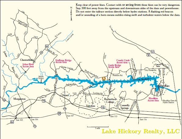
Lake Rhodhiss offers 90 miles of shoreline and a surface area of approximately 3,060 acres between the counties of Burke and Caldwell. Because Lake Rhodhiss is a reliable source of water for the nearby cities of Granite Falls, Lenoir, Morganton and Valdese, Duke Energy keeps the lake levels fairly even year round. The energy company, also, provides four boat access areas and one bank fishing area in cooperation with the North Carolina Wildlife Resources Commission.
- Johns River Access Area
- Huffman Bridge Access Area
- Castle Bridge Access Area
- Conley Creek Access Area
- Rhodhiss Access Area
Lake Rhodhiss is a favorite among fisherman in Western NC. Many fishing tournaments are held here because of the variety of different species of fish.
The full pond elevation of the lake is 995.1 feet and it has a sandy bottom.
Subdivisions on this lake include: Doe Run and Broadwater Landing, Lake Vista in Caldwell county and Paradise Harbor, Harbor Ridge, Lake Vista, Waterside and The Settings in Burke County.
Currently, there is no gas on this lake so you have to haul it in gas for your watercraft.